
Crop loss assessment is one of the most important parts of agricultural risk management. When crops are affected by flood, excess rain, drought, hail, wind, or other field-level damage, quick and accurate documentation becomes essential. Traditional field inspection can take time, especially across large agricultural areas, and manual assessment may not always provide the same level of visibility across the entire field.
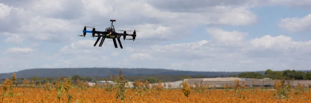
A crop insurance & assessment drone helps improve this process by providing aerial field review, mapped coverage, and visible damage documentation. For farmers, agri businesses, survey teams, and agricultural projects, drone-based assessment supports faster crop damage review and better field-level evidence for crop loss evaluation.
Why Crop Insurance Assessment Needs Better Field Visibility
Crop loss is often spread unevenly across the land. Some sections may be heavily affected, while other areas may show only partial damage. In such cases, aerial visibility becomes useful because it helps review the affected farm more clearly and supports more organized field assessment.
A crop damage assessment drone can help users inspect large farms faster, review visible damage patterns, and identify the areas that need priority verification. This improves the overall assessment process and helps create more structured documentation for crop insurance and field-loss review.
How Drones Help in Crop Loss Assessment
Drone-based assessment helps convert visual field damage into clearer mapped evidence. Instead of depending only on ground-level inspection, drones make it easier to review field conditions from above and understand the scale of damage more efficiently.
A crop loss assessment drone is commonly useful for:
- reviewing large damaged fields faster
- documenting visible crop loss more clearly
- identifying affected zones across the farm
- improving field-level damage visibility
- supporting crop loss reporting and assessment workflows
- reducing the time needed for repeated ground inspection
This makes a drone survey for crop loss assessment a practical option where speed, area coverage, and visible evidence are important.
Applications of Crop Insurance & Assessment Drones
Post-Flood Crop Damage Assessment
Flooded fields often need quick review to understand the extent of visible crop loss. A drone helps assess the spread of affected zones and supports better damage documentation across larger areas.
Hail and Storm Damage Review
After hail, strong wind, or severe weather, crop damage may appear in irregular patterns. A post-disaster crop assessment drone helps inspect the field more efficiently and identify the visibly affected sections.
Drought and Stress-Related Field Loss Observation
In drought-affected conditions, a drone can support broader field review and help document visible crop decline or uneven loss patterns across the farm.
Crop Loss Documentation for Insurance Workflows
A drone for crop insurance claims can help generate clearer field visuals, area-based review, and practical documentation that supports crop loss evaluation processes.
Large-Scale Agricultural Assessment
For estates, FPOs, agri businesses, and larger farming operations, aerial review helps cover wider areas faster than manual inspection alone.
Area-Based Damage Mapping
A drone can help review the affected sections of a farm and support more organized assessment when crop loss is spread across different parts of the field.
Benefits of Using a Crop Insurance & Assessment Drone
Faster Field Review
A drone helps inspect large agricultural areas in less time than manual ground-only checking.
Better Damage Visibility
Aerial review makes it easier to observe the spread and pattern of visible crop damage across the field.
More Organized Assessment
Mapped field review supports better identification of affected sections and clearer field-level observation.
Reduced Manual Effort
Drone-based inspection helps reduce repeated physical checking across wide damaged areas.
Useful Evidence for Review and Reporting
A crop insurance drone helps create stronger visual support for field documentation, reporting, and crop loss evaluation workflows.
Practical Support for Large Farms
For larger agricultural areas, drone-based assessment helps improve speed and visibility during crop loss review.
What a Crop Insurance & Assessment Drone Can Help Document
A drone used for crop insurance and field assessment can support:
- visible crop damage areas
- affected field sections
- flood-impacted zones
- standing water patterns
- lodged or damaged crop sections
- irregular field-level loss patterns
- mapped field visuals for reporting
- image-based evidence for review
A UAV crop damage assessment workflow is especially useful when broader field coverage and visual proof are important.
When Drone-Based Crop Insurance Assessment Is Most Useful
Drone-based assessment is most useful when:
- crop loss affects large field areas
- visible damage is spread unevenly
- faster documentation is needed
- post-disaster field review is required
- field evidence is needed for organized reporting
- multiple plots need assessment in limited time
This makes a crop insurance drone in India especially relevant for agricultural regions where field size, weather events, and assessment speed all matter.
Who Can Benefit from Crop Insurance & Assessment Drones
This type of drone solution can be useful for:
- farmers with large damaged field areas
- FPOs and cluster farming groups
- agri businesses handling multiple plots
- agricultural project teams
- farm survey and assessment operations
- large estates and field-management groups
Why Drone-Based Insurance Assessment Is Becoming More Important
Agriculture depends heavily on timely decisions, especially after visible crop damage. The faster the affected area is reviewed, the easier it becomes to organize field-level assessment and planning. A crop insurance & assessment drone helps improve visibility, reduce delay in field review, and support a more efficient crop loss evaluation process.
As agricultural technology adoption continues to grow, drone-based assessment is becoming a more practical tool for field documentation, visible damage mapping, and structured agricultural review.