
Construction and infrastructure projects need accurate information from the beginning. Before any work starts, teams must understand the land, site conditions, boundaries, levels, and layout. If planning is based on incomplete or outdated information, it can lead to delays, rework, higher costs, and poor site decisions.
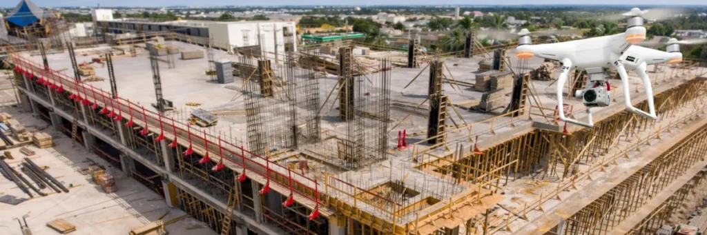
This is where drone mapping is becoming very useful. Drone mapping helps construction and infrastructure planning by giving fast, accurate, and detailed aerial views of project sites. It allows teams to understand the site better, plan work more clearly, and monitor progress more efficiently.
In simple words, drone mapping helps planners see the site properly before making important decisions.
What Is Drone Mapping?
Drone mapping is the process of using drones to capture aerial images and site data, which are then used to create maps, models, and visual site information.
These outputs may help with:
- site surveys
- land measurement
- topographic understanding
- project planning
- route planning
- progress tracking
- infrastructure design support
Drone mapping is used in construction, roads, bridges, utilities, industrial sites, land development, and other large projects where accurate site understanding is important.
Why Site Planning Needs Better Data
Good planning depends on good site information. In construction and infrastructure projects, teams need to know:
- the shape and condition of the land
- slopes and elevation changes
- access points
- surrounding features
- existing structures
- site boundaries
- obstacles that may affect the project
If this information is unclear, planning becomes harder. Teams may face errors in layout, delays in execution, or problems during construction.
Drone mapping helps reduce these issues by giving a clear view of the site early in the planning process.
Faster Site Surveys
One of the biggest benefits of drone mapping is speed.
Traditional site surveying and manual field checks can take a lot of time, especially on large or difficult land areas. Drone mapping can cover the same site much faster and provide visual data in a shorter time.
This helps project teams:
- save time in early planning
- review large areas quickly
- start design work sooner
- reduce delays in site assessment
For construction and infrastructure projects, faster surveys can improve the overall project timeline.
Better Understanding of the Land
Construction planning depends heavily on land conditions. Uneven surfaces, slopes, water flow paths, and elevation changes can all affect design and execution.
Drone mapping helps teams understand the land more clearly by providing a top view of the full site. This makes it easier to study:
- terrain shape
- level differences
- cut and fill needs
- drainage patterns
- difficult areas
- natural and man-made features
This better understanding supports more accurate planning and reduces guesswork.
Helps in Project Layout Planning
Before construction begins, planners must decide where structures, roads, utilities, and work zones will be placed. Good layout planning is very important because mistakes at this stage can affect the entire project.
Drone mapping helps by giving a clear and updated site view. Teams can use this information to plan:
- building positions
- road alignments
- utility routes
- storage areas
- access roads
- work zones
- equipment movement paths
When the site is clearly visible, layout planning becomes easier and more reliable.
Supports Infrastructure Route Planning
In infrastructure projects such as roads, rail, pipelines, transmission lines, or drainage systems, route planning is very important.
Drone mapping helps teams study the corridor or project area more efficiently. It becomes easier to identify:
- land conditions
- existing structures
- obstacles
- route alignment possibilities
- access challenges
- surrounding development
This helps engineers and planners choose better routes and reduce planning mistakes.
Improves Accuracy in Planning
Accurate planning is essential in both construction and infrastructure work. Even small errors in site understanding can lead to major issues later.
Drone mapping improves planning accuracy by providing more complete visual data from the site. This can support:
- better measurements
- clearer boundaries
- more reliable planning decisions
- improved design coordination
- reduced rework during execution
When teams work with clearer site data, they can plan with more confidence.
Useful for Large and Difficult Project Sites
Drone mapping is especially helpful on large sites or in locations that are difficult to inspect fully on foot.
This includes:
- highway projects
- industrial developments
- bridge locations
- utility corridors
- large construction sites
- land development projects
- hilly or uneven terrain
- remote project areas
In these conditions, manual inspection alone may be slow and incomplete. Drone mapping helps by giving faster and wider site visibility.
Helps Identify Site Challenges Early
One major advantage of drone mapping is early issue identification. Before project work begins, teams need to know if there are site conditions that may create problems later.
Drone mapping can help reveal:
- uneven ground
- drainage concerns
- access limitations
- nearby obstructions
- boundary issues
- unused or risky areas
- land conditions that may affect equipment movement
Finding these challenges early helps teams plan better and avoid delays during execution.
Better Communication Between Teams
Construction and infrastructure projects involve many people, including planners, engineers, contractors, consultants, and project managers. Good communication between these teams is important.
Drone mapping helps because it provides visual site information that is easy to understand. Instead of relying only on written reports or verbal explanations, teams can refer to actual mapped site visuals.
This improves:
- planning discussions
- design coordination
- site review meetings
- progress understanding
- decision-making across departments
Clear visuals make communication easier and more effective.
Helps Monitor Project Progress
Drone mapping is not only useful before construction starts. It is also valuable during the project.
As work progresses, drone mapping can help teams:
- review site development
- compare work stages
- monitor area coverage
- check layout progress
- identify visible changes over time
This helps project teams stay informed and take action if needed.
Saves Time and Manual Effort
Large construction and infrastructure projects often require repeated site visits and visual checks. Drone mapping reduces some of this manual effort by allowing teams to review the site more efficiently.
Instead of depending only on long field visits, drone-based maps and visuals help teams inspect more in less time. This improves productivity and helps teams focus on planning and execution.
Supports Better Decision-Making
The main value of drone mapping is not only the images. It is the better decisions that come from better site understanding.
When planners can clearly see:
- where the land rises or falls
- where access is limited
- where layout changes may be needed
- where site conditions are affecting planning
they can make more informed decisions.
This helps improve project planning quality and reduces avoidable mistakes.
Where Drone Mapping Is Most Useful
Drone mapping is especially useful in:
- building construction projects
- road and highway planning
- bridge projects
- industrial developments
- utility infrastructure
- railway corridors
- land development
- commercial site planning
- large public works projects
In all these cases, site visibility and planning accuracy are very important.
Limitations to Consider
Although drone mapping is very useful, it also has some limitations.
- trained operators are needed
- weather can affect operations
- some projects still need detailed ground verification
- data processing and interpretation must be handled properly
- not every planning decision can be made from aerial visuals alone
So, drone mapping should be seen as a strong support tool for planning, not a complete replacement for technical site work.